Ridgeons, Cromwell Road: Supplementary Planning Document
2. Site and surrounding area
2.1. Chapter 2 of the SPD presents survey information about the site and the wider area. This background work has been undertaken to inform the development principles, parameters for change and the Framework Plan as set out in later chapters.
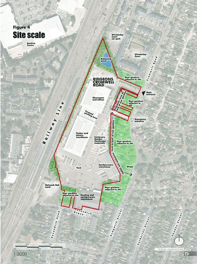
2.2. The Ridgeons site (Figures 4-19)
(2) Figure 4: Site Scale
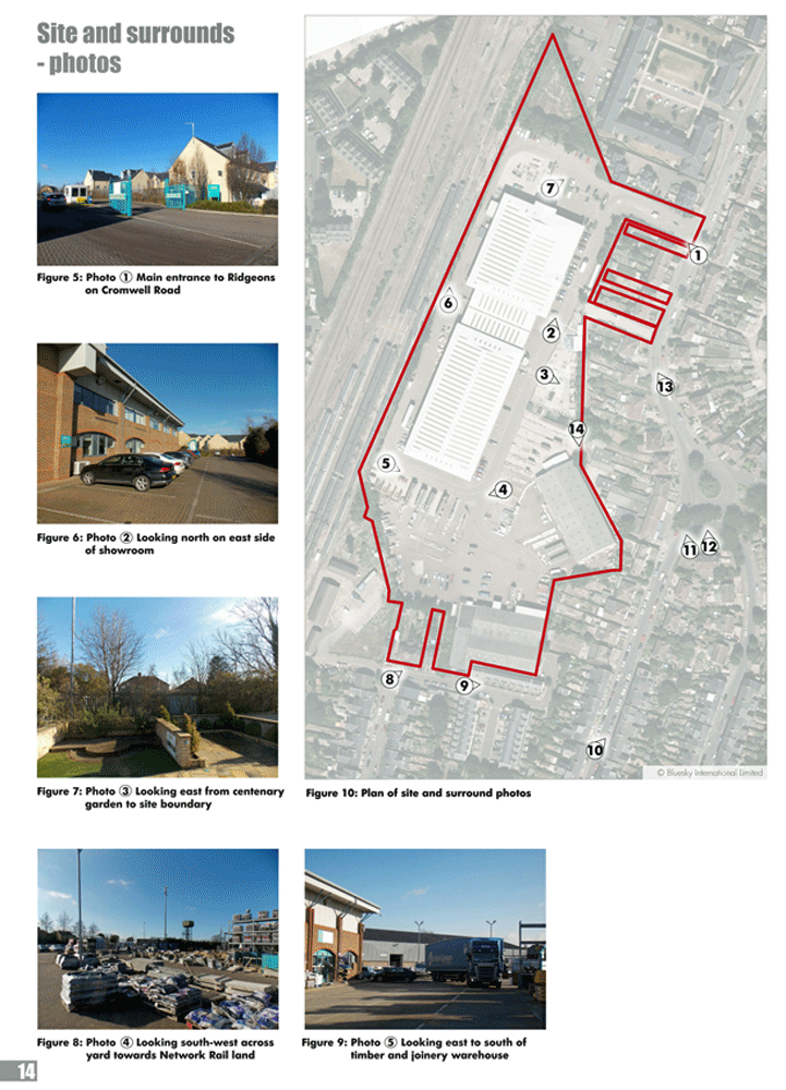
(1) Figure 11-19: Site and surrounds
2.2.1. Ridgeons Timber and Builders Merchants opened the 75 Cromwell Road branch in 1996. The Ridgeons Group has owned the site since the 1920s, when it was used as a timber yard. The 3.27 hectare site is located on the western side of Cromwell Road behind residential buildings.
2.2.2. Land ownership
Ridgeons own the entire site at 75 Cromwell Road and also own the following properties around the site:
- 127, 129 and 131 Cavendish Road
- 55, 57, 61 and 73 Cromwell Road
2.2.3. Vehicle access
The main vehicle access to the site is from Cromwell Road. There is a secondary emergency vehicle access to the site further to the south on Cromwell Road. The site includes frontage to Cavendish Place, but there is no route through from the site.
2.2.4. Buildings on the site
There are four principal buildings on the site, which are separated by large areas of paving used for parking, loading and displaying materials. None of the buildings are of architectural or heritage value.
2.2.5. The main Ridgeons building is the largest on the site - approximately 160m x 40m - and contains a showroom, offices and warehouse. It has a ridge line which is 12m in height, equivalent to approximately 4 residential storeys. The sanitaryware warehouse is on the eastern boundary of the site and has a ridge line 9.5m in height, approximately equivalent to 3 residential storeys. The heating and sanitary warehouse on the southern boundary of the site has a ridge line of 8.5m.
(1) 2.2.6. Landscape
Being a builders' merchants the site has few landscape features. To the north of the site there is a 3m deep man-made water attenuation feature surrounded by trees and hedgerows. Much of the boundary of the site is planted with trees and vegetation.
(3) 2.2.7. Ecology
A Preliminary Ecological Appraisal has been carried out. It concludes that the site has a low ecological value. Some small areas of vegetation are present but are of poor quality and represent common and widespread habitats.
2.2.8. Topography
The site slopes downhill from south west to north east by 3.5m.
(1) 2.2.9. Drainage and flooding
The site is located in a low flood risk area (Flood Zone 1). The site currently has a high surface water run off rate due to the large area of impermeable surfaces. When the site is redeveloped, less surface water attenuation is expected to be required. Opportunities exist to introduce sustainable urban drainage systems such as ditches, swales and ponds as part of future proposals.
2.2.10. Archaeology
The site falls within an area where archaeological assets have previously been identified. Therefore archaeological investigations could be required before any redevelopment of the site is undertaken.
(1) 2.2.11. Noise
Noise and vibration surveys have been carried out. The removal of the main Ridgeons building could, if the site were cleared, increase noise levels at the rear elevations of 43-73 Cromwell Road (odd-numbered houses only). However, the attenuating effect of the existing buildings would be adequately compensated for by any new development of domestic scale or higher.
2.2.12. Properties and routes around the site
There are neighbouring properties with rear gardens to the north, east and south of the site: Winstanley Court, Cromwell Road and Cavendish Place. The western side of the site bounds the railway line.
2.2.13. There is a pedestrian path which runs behind 55-73 Cromwell Road, between the main and secondary entrances. There is a vehicle track which runs between the secondary access and the group of shops next to the roundabout on the southern end of Cromwell Road behind 23-53 Cromwell Road. The vehicle track includes access to properties and garages. It is understood that both the pedestrian path and vehicle track are unregistered land that adjacent properties have rights of access over. The pedestrian path and the vehicle track are outside of the Ridgeons site boundary.
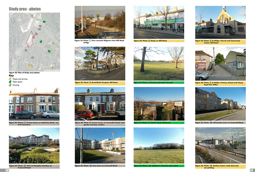
2.3. The Ridgeons site within the local area and Cambridge (Figures 20-37)
(1) Figure 20: Site in the locality
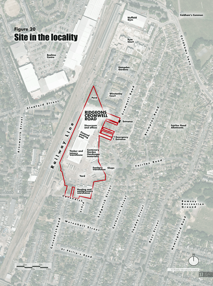
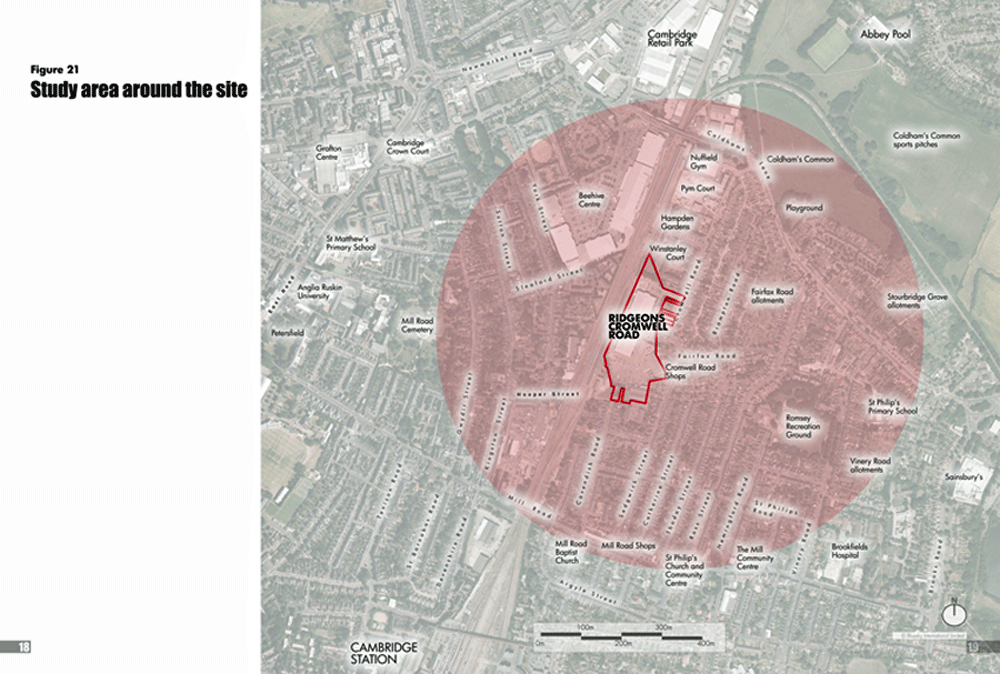

2.3.1. The Ridgeons site is within the Romsey Ward of Cambridge and within close proximity to the Petersfield and Abbey Wards. The site is approximately a 30 minute walk or 7 - 8 minute cycle ride (1.5 miles) to central Cambridge.
2.3.2. For the purposes of the SPD a study area has been identified to help set a boundary for analysing the wider area around the Ridgeons site. The study area includes: Coldham's Common, Romsey Recreation Ground, three allotment areas, Brookfields Hospital, Vinery Road Post Office, St Philip's Primary School and the shops and services on Mill Road.
2.3.3. This study area has been reviewed under the following six themes:
- History and heritage,
- Land use,
- Transport and parking,
- Building heights and types,
- Open space,
- Character and form.
2.4. History and heritage (Figures 38 - 52)
(1) Figure 38-41: Existing heritage designations
2.4.1. Heritage assets
The Mill Road Conservation Area is located south and west of the site and comprises two character areas:
- Character Area 1: Mill Road and St Matthews Area
- Character Area 2: Romsey Town Area
2.4.2. The entire Ridgeons site is located outside of this Conservation Area. The northern boundary of Character Area 2: Romsey Town Area is adjacent to the southern boundary of site.
2.4.3. There are three listed buildings within the study area:
- St Matthew's Church, Grade II Listed
- Mill Road Cemetery, Grade II Listed
- Mill Road Library, Grade II Listed
2.4.4. The development of Romsey Town and the Ridgeons site
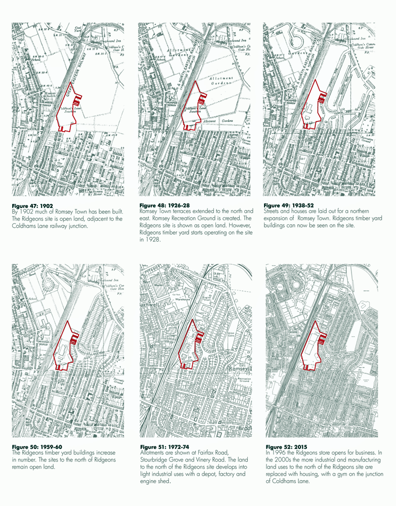
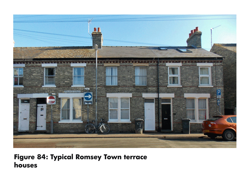
The majority of Romsey Town was built between 1880 and 1900 primarily as 2- storey terrace houses on narrow streets to the north of Mill Road and to the west of the railway line. Historic maps illustrate the development of the Cromwell Road site and the surrounding area. The Ridgeons site is located to the north of the Romsey Town terraces and remained as open land until Ridgeons opened a timber yard on the site in 1928.
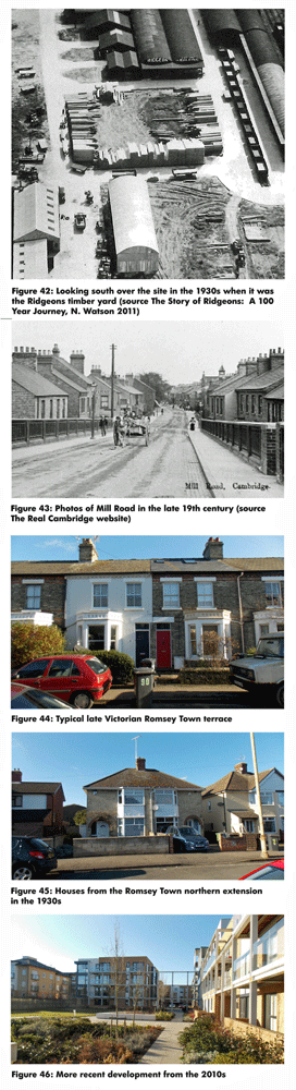
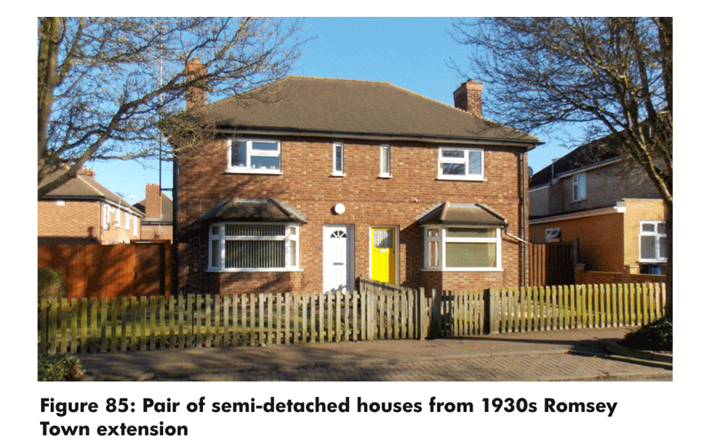
2.4.5. In the 1930s there was a northern extension to Romsey Town, with houses built on allotment gardens. However, the land directly north of the Ridgeons site remained undeveloped until the 1960s, when light industrial and manufacturing businesses begin to locate in the area. The Ridgeons site remained a timber yard until 1996, when the Ridgeons store opened for business.
2.4.6. In the early 2000s the light industrial and manufacturing land uses to the north of Ridgeons site were replaced with residential development, predominately in the form of flat blocks of 4-6 storeys.
2.5. Land Use (Figures 53 - 60)
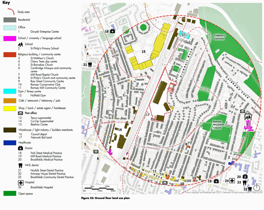
Figure 53: Ground floor land use plan
(1) 2.5.1. The area around the Ridgeons site is predominately residential, with a number of other land uses.
2.5.2. Within approximately a five minute walk /0.25 mile:
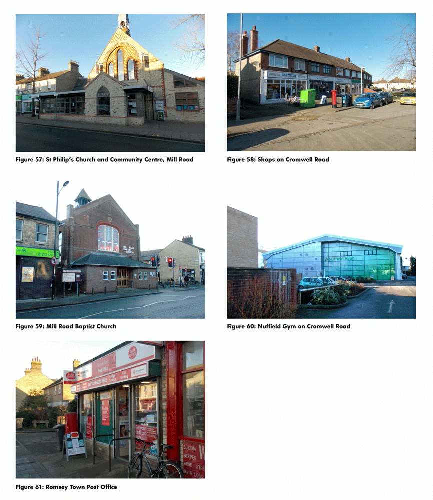
- A row of shops on the corner of the mini roundabout on Cromwell Road
- Nuffield Gym
2.5.3. Within approximately a ten minute walk /0.5 miles:
- The shops and services on Mill Road, including two local supermarkets, cafes, restaurants, community centres and places of worship and a post office
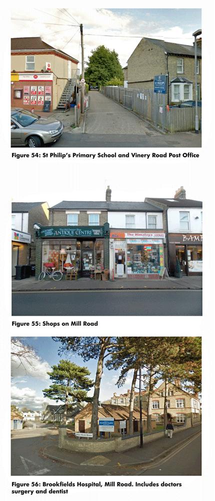
- St Philip's Primary School
- Vinery Road Post Office
(1) 2.5.4. Within approximately a 15 minute walk/0.75 miles:
- The larger retail outlets at the Beehive Centre, includes Asda, M+S, Toys R Us and others
- York Street Medical Practice, Brook Street Medical Practice and Mill Road Medical Practice
- Antwerp House Dental Practice, Brookfields Dental Practice and Antwerp House Dental Practice
- Brookfields Hospital
2.5.5. Within approximately a 20 minute walk / five minute cycle ride / 1 mile:
- Cambridge Train Station
- Grafton Shopping Centre
2.5.6. Within approximately a 30 minute walk / 7-8 minute cycle ride / 1.5 miles:
- City Centre / Market Square
- Midsummer Common
(2) 2.5.7. Medical practice provision
There are four medical practices in the NHS catchment area of the site - three of these are within the study area. There are also four dental practices and one hospital. Brookfields Community Hospital offers a range of services, including speech therapy, rehabilitation, physiotherapy and palliative care.
(1) 2.5.8. As part of the preparation of the SPD, discussions have been held with the NHS. The NHS has said that its preference would be to seek improvements to the existing local practices rather than provide new facilities on the Ridgeons site. On site provision may however be required.
(6) 2.5.9. School provision
There is one primrary school in the catchment area of the site. As part of the preparation for the SPD, discussions have been held with Cambridgeshire County Council. The County Council is currently preparing a strategic plan to deliver improved primary and secondary school places, catering for the planned growth of the city as a whole. The strategic plan will identify suitable locations for new or expanded schools. Future developments, including this one, will then be likely to be required to make a financial contribution towards the delivery of these schools.
2.5.10. The County Council has also advised that additional 'early years' places for under fives is likely to be needed as a result of this development. Provision may be required on site.
2.5.11. Local housing
Based on information provided by Royal Mail, residential properties in the study area comprise circa 18% flats and 82% houses. Approximately 55% of the housing in the study area is owner occupied, 16% rented from a housing association or the Council, 25% privately rented and 4% rented from another source.
2.6. Transport and access (Figures 62 - 74)
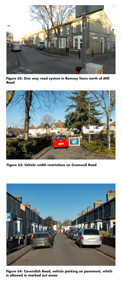
(1) Figure 62-64: photos of surrounding streets
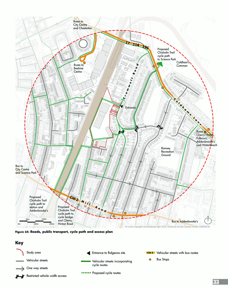
(2) Figure 65: Roads, Public transport, cycle path and access plan
(2) 2.6.1. Streets
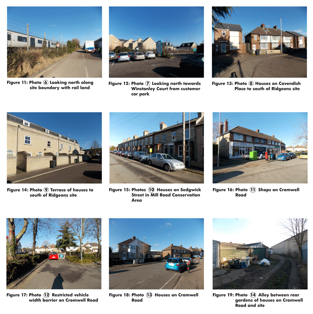
The late 19th century Romsey Town streets to the south of the site are generally narrow, one way and with parking partially on the pavement. Cavendish Road for example has a carriageway which is 6m wide and parking on both sides of the street, making a clearance of only 3m for vehicles on the two way street. Most of the streets in Romsey Town south of Fairfax Road are one way.
2.6.2. The streets laid out in the 1930s to the north of the site are generally wider. Cromwell Road has a carriageway width of 8m, with parking on one side of the street, making a vehicle clearance of 6m on the two way street.
2.6.3. Fairfax Road has vehicle width restrictions, preventing larger vehicles from travelling through the narrow streets of Romsey Town.
2.6.4. Buses
There are good bus links within less than a 10 minute walk of the Ridgeons site on Mill Road (Citi 2) and Coldhams Lane (17, 114 196). There are regular buses into Cambridge City Centre, to Addenbrooke's Hospital and other surrounding areas and villages.
2.6.5. Rail
Cambridge Railway Station is within a 20 minute walk or 5 minute cycle ride (1 mile) of the Ridgeons site.
(2) 2.6.6. Parking
The streets around the Ridgeons site do not have a controlled parking zone (CPZ).
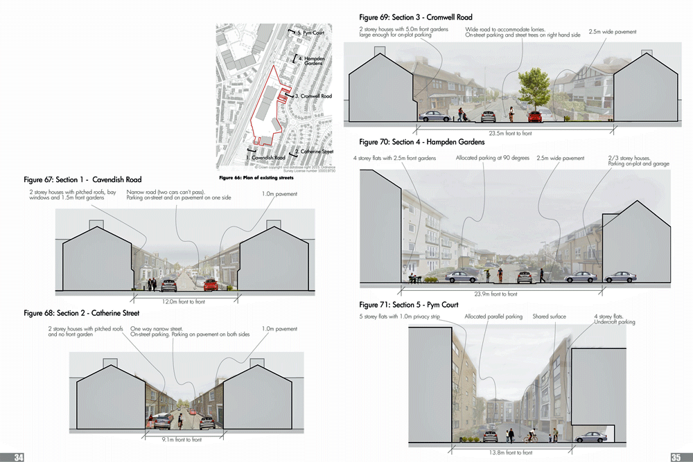
2.6.7. Existing streets
Typical street sections around the site are illustrated below. The street sections illustrate different contextual approaches to front boundaries/gardens, parking, planting, pavement widths and road widths. All dimensions are approximate.
(1) Figure 66-71: Street sections
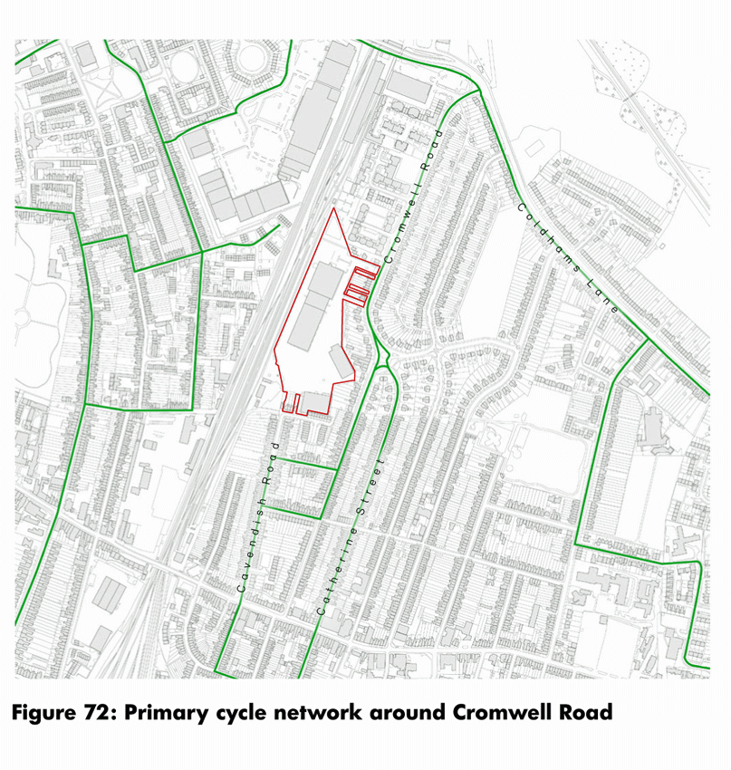
(3) 2.6.8. Cycle and pedestrian network
There is a signed primary cycle network on several of the streets around the site, such as Cavendish Road, Cromwell Road, Sedgwick Street and Catherine Street (please see figure 72)
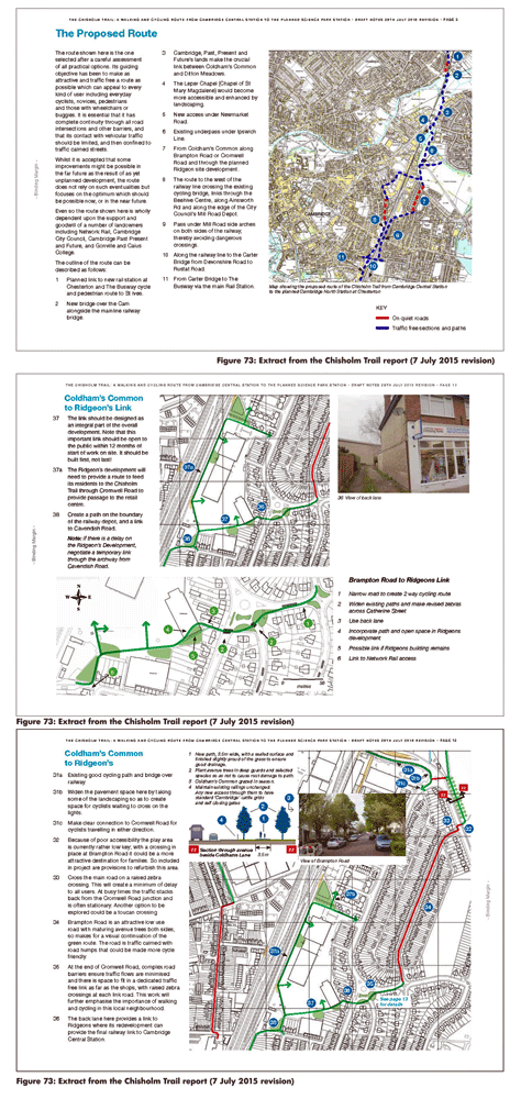
(4) 2.6.9. The most up-to-date proposals for the Chisholm Trail, illustrated here, recommend a new north- south cycle route through Cambridge utilising land next to the railway. The proposed route is shown to run next to the railway behind the houses on Cavendish Road, across the adjacent Network Rail site, through the southern side of the Ridgeons site and through to the shops on the Cromwell Road mini-roundabout. A secondary spur is shown running north through the Ridgeons site to Cromwell Road.
(1) Figure 72: Primary cycle network around Cromwell Road
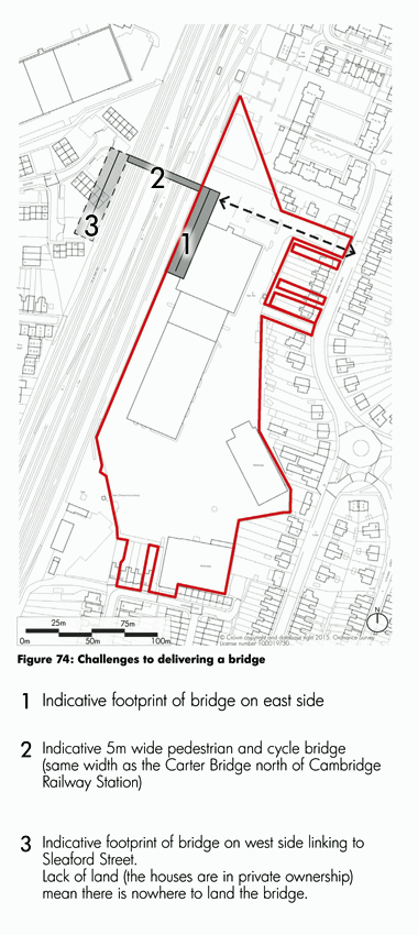
(8) 2.6.10. Link across the railway
In preparing this SPD a new pedestrian bridge linking the Ridgeons site with the west side of the railway line has been investigated. The scoping work for the bridge was in response to a request from some local residents during consultation. The potential bridge has been discussed with the County Council acting as Local Highway Authority. It is not considered that an additional bridge at this location is needed. While a bridge would provide a more direct crossing point over the railway, the two existing crossing points at Mill Road and Coldhams Lane are close by. Connections from these crossing points to key destinations are relatively good. In contrast, there is no obvious connecting route from a potential bridge on the western side of the railway and links to key destinations would not be demonstrably improved.
(2) 2.6.11. An indicative location for a bridge is illustrated in Figure 74. A new bridge would require ramped access and therefore the extent of land required on both sides of the railway line would be considerable. There is no available space on the western side of the railway line to provide a place to land the bridge. To acquire the required land the Council would need a compulsory purchase order (CPO) to make way for a new bridge.
(2) 2.6.12. To obtain a CPO the County Council would have to apply for special powers and present a very strong 'for greater good' case. For the reasons given above, the benefits offered by a new bridge are not considered to be sufficient to justify the demolition of existing dwellings or the application for a CPO.
(2) 2.6.13. In light of the above it is considered that the provision of a new bridge is not appropriate, necessary or deliverable.
(1) Figure 74: Challenges to delivering a bridge
2.7. Open space (Figures 75 - 83)
(1) Figure 75: Open Space plan
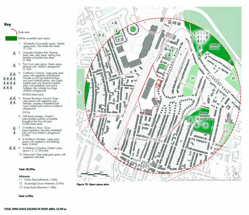
(4) 2.7.1. There are a number of open spaces within a 5-10 minute walk of the Ridgeons site:
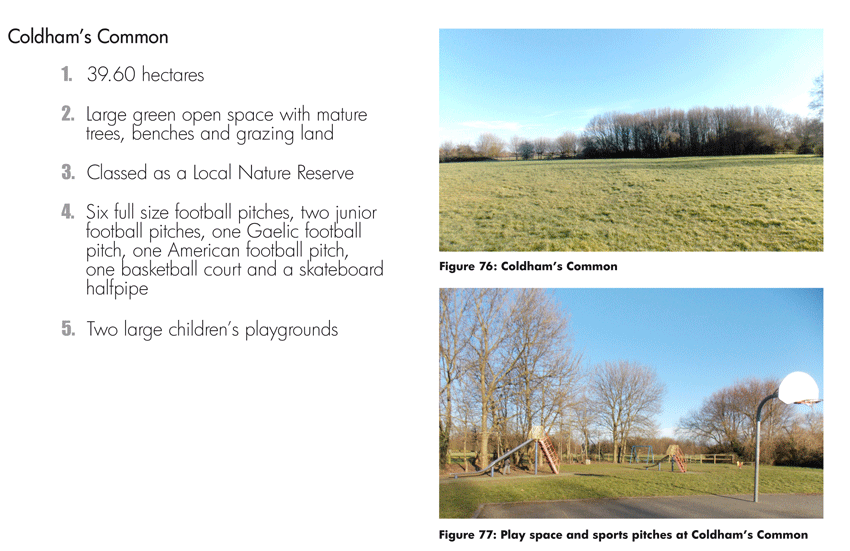
Coldham's Common
Coldham's Common is a large area of 'common land' with outdoor sports facilities including two large children's playgrounds. Given its size it has the capacity to accommodate most types of park activity.
(1) Figure 76-77: Coldham's Common
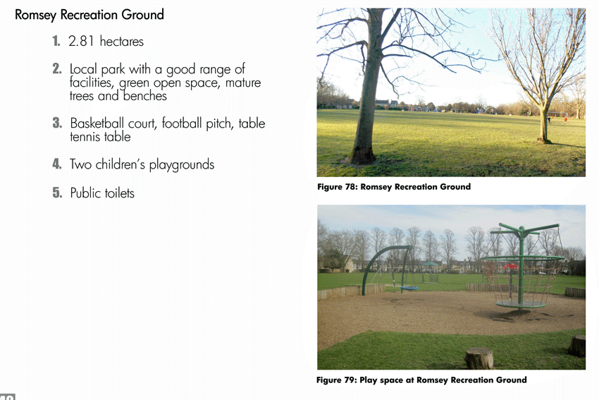
Romsey Recreation Ground
Romsey Recreation Ground is 2.81 hectares and represents a successful local park in terms of size, a range of different typologies of open space and amenities, including a basketball court, football pitch and two children's playgrounds.
Figure 78-79: Romsey Recreation Ground
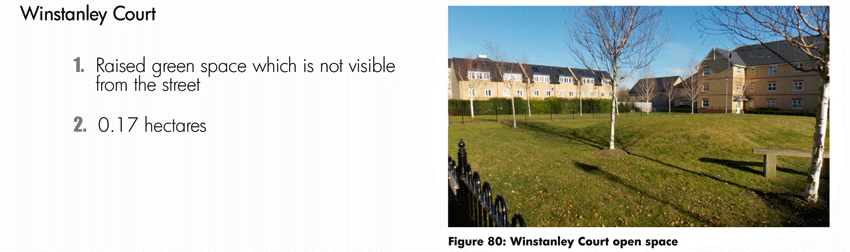
Winstanley Court
The open spaces on Cromwell Road are small and could be described as pocket parks. The open space at Winstanley Court is essentially a raised grass area and is not visible from Cromwell Road.
(1) Figure 80: Winstanley Court open space
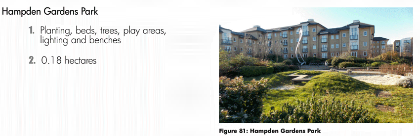
Hampden Gardens Park
The open space at Hampden Gardens is visible from the street and designed to be a series of different character areas.
(1) Figure 81: Hampden Gardens Park
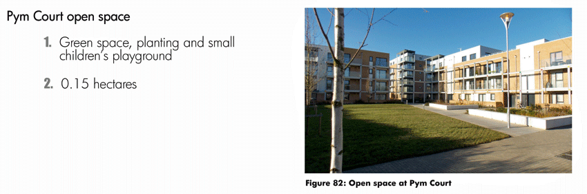
Pym Court open space
The open space at Pym Court is visible from the street and has a 'no ball games' sign. There is a children's playground to the rear of the site.
(1) Figure 82: Pym Court open space
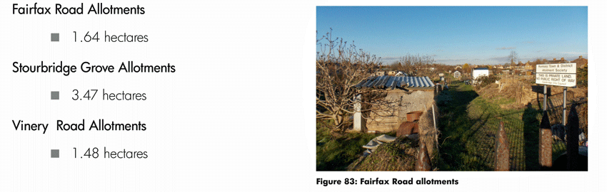
Allotments
There are three allotments sites in the vicinity.
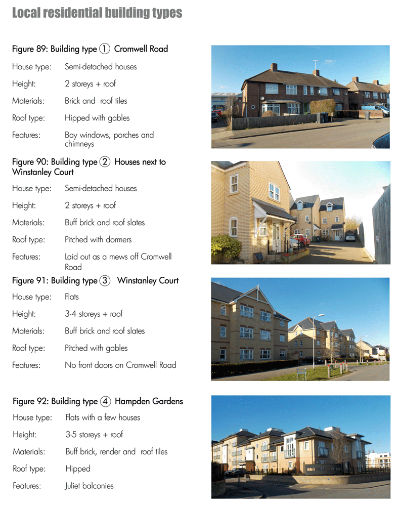
2.8. Building heights and types (Figures 84 - 96)
(1) Figure 87: 3 storey houses in the Pym Court development on Cromwell Road

(1) Figure 88: Building heights plan
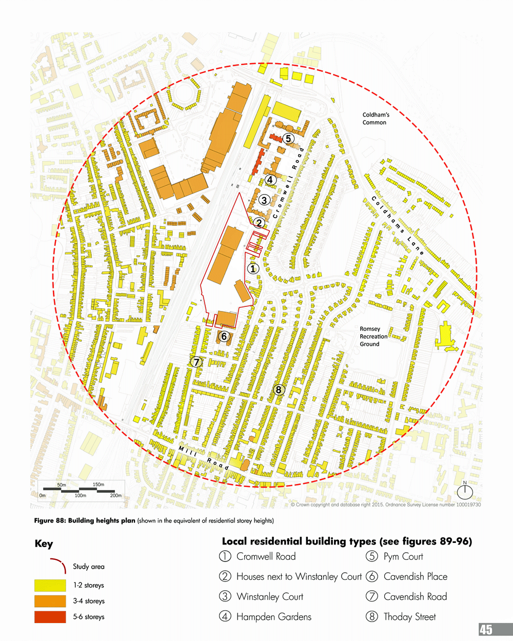
(2) 2.8.1. Residential building heights and types
The Victorian houses in Romsey Town are generally 2 storey, with pitched roofs and chimneys and arranged in long terraces. In terms of materials, most of the houses are faced with brick and have sliding sash timber windows. The houses generally fall into two types. The first type is a slightly larger house with a hall, bay window and front garden, such as the houses on the northern end of Cavendish Road. The second type of house is narrower, with no hall, bay window or front garden, such as the houses on Thoday Street.
2.8.2. The houses in the 1930s extension of Romsey Town (to the north and east of the Ridgeons site) are generally larger with bigger front and rear gardens than the Victorian houses. These houses are generally 2 storey, faced with brick and/or render and include hipped roofs, gables, porches and casement windows. The houses are generally semi-detached or in short terraces.
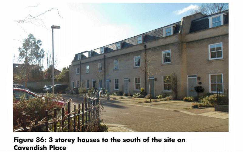
2.8.3. Directly to the south of the Ridgeons site is a more recent development of 2 and 3 storey houses on Cavendish Place. These houses are faced with buff brick and have mansard roofs and dormer windows.
(1) 2.8.4. To the north of the site there are three more recent residential developments - Winstanley Court, Hampden Gardens and Pym Court - which range from 3-6 storeys. The buildings in Winstanley Court are 3 storey buff brick to Cromwell Road and 4 storeys next to the railway line. The buildings in Hampden Gardens also feature buff brick, range in height from 3-5 storeys and have hipped roofs and juliet balconies. The buildings in Pym Court range in height from 3-6 storeys, are a mixture of brick and render and have flat roofs.

2.9. Character and form (Figures 97 - 106)
2.9.1. 'Character and form' is defined here as a combination of the layout of the buildings and streets, the height and appearance of the buildings, the amount and distribution of open space and the density (number of homes in a given area) of a development.
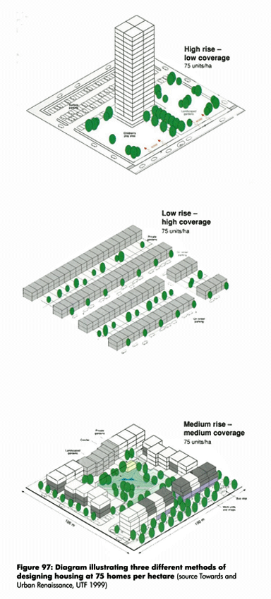
(1) 2.9.2. As a Supplementary Planning Document (SPD), this document is required to support policies and objectives in the Local Plan. The allocation in the emerging Local Plan for the Ridgeons site is for 75 homes per hectare.
(2) 2.9.3. Figure 97 broadly illustrates three different but basic diagrammatic approaches to character and form achieving 75 homes per hectare on identically sized sites. To achieve the density required and public space, a medium rise approach with houses and flats would appear to be most appropriate for the site and the context.
Figure 97: Diagram illustrating three different methods of designing housing at 75 homes per hectare
2.9.4. Illustrated below are eight character and form studies of the local area around the Ridgeons site. These show different approaches to character and form and the resulting density.
(1) Figure 98: Figure ground plan identifying character areas
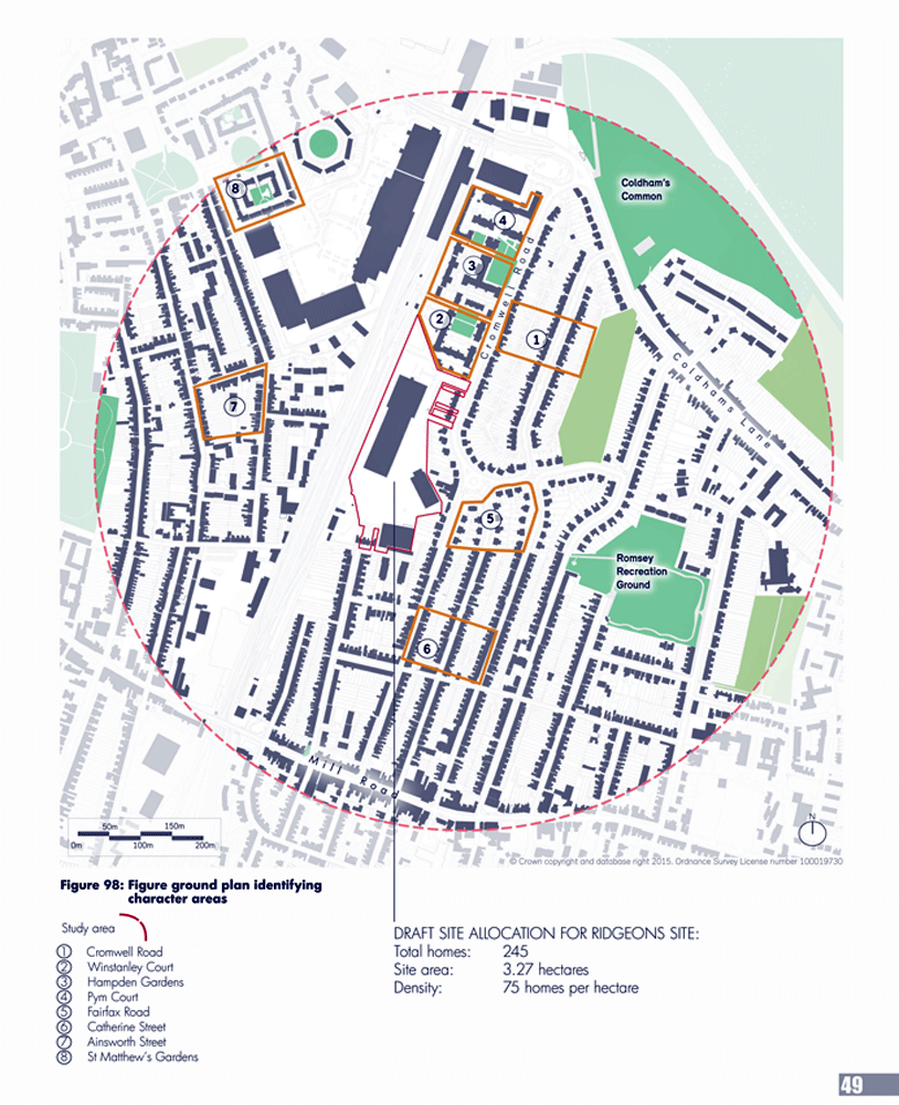
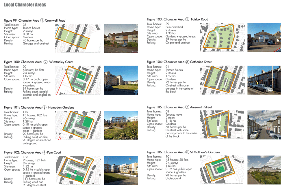
(1) 2.9.5. To deliver 75 homes per hectare and public open space, the studies imply that a combination of houses and flats will be required, as well as buildings of 4 or more storeys on parts of the site.
2.9.6. Car parking will be dealt with in a range of solutions, including: on street parallel parking, head-on parking (90 degree), undercroft and parking courts.
2.10. Key objectives (Figure 107)
(3) Figure 107: Constraints and opportunities
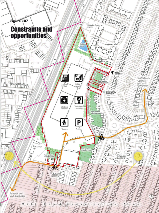
(10) 2.10.1. This chapter has highlighted the key planning and design considerations on and around the site. The key objectives are summarised below:
- Provide a mix of flats and houses at 75 dwelling units per hectare
- Protect the amenity and access rights of existing neighbouring properties
- Utilise the existing access roads into the site
- Create pedestrian and cycle routes through the site, including the Chisholm Trail
- Respect the adjacent Mill Road Conservation Area
- Provide a large, welcoming and accessible public open space
- Address opportunities for sustainability and ecology on the site
- Ensure existing and new homes are protected from the noise of the rail line
- Provide new homes that maximise daylight and sunlight
- Provide adequate parking in a variety of typologies
- Accommodate the potential for a medical practice and/or an early years facility if needed