Draft North East Cambridge Area Action Plan
7.7 Managing motorised vehicles
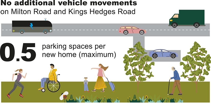
Figure 41: Infographic showing key measures in the policy
In order to create a walkable, cyclable and sustainable neighbourhood which does not increase pressure on the road network around the area, the overall number of vehicle movements in North East Cambridge will have to be carefully managed and significantly reduced from current levels. To achieve this, development will be subject to strict trip budgets which will limit the number of vehicle trips allowed to and from each site, and reduced levels of car parking. This policy sets out the trip budget principles and quotas, and the ratio of parking spaces that will be permitted for new development..
- There is concern that if developed with traditional mode shares, the development would cause unacceptable problems on the surrounding highway network.
- However, the majority of respondents understand the opportunity that this site affords to provide a much more sustainable development and there is general support for low car usage as long as this is supported by improvements to public transport and provision for non-motorised users.
- The principle of a site wide vehicular trip budget is broadly supported, but existing developments must play their part in making the development significantly less reliant on private cars.
- There was also broad support for the principle of a much-reduced approach to parking, but again the need for equity across the site was emphasised, as well as not simply displacing parking to other, undesirable locations such as surrounding streets or villages.
How your comments and options have been taken into account
- The Transport Evidence Base undertook a modelling exercise to understand the impact on the highway network if a range of different development scenarios were built out on the site. The work considered what the impact would be if current mode shares on the site were maintained. It showed that a business-as-usual approach would multiply existing local highway delays to an unacceptable level which it would not be possible to mitigate.
- Lack of spare highway network capacity in and around the area particularly at peak times, the limited opportunities to increase this in the future, the additional pressure to be placed on the road network by other developments such as the new town north of Waterbeach and the lack of wider policy support to increase general highway capacity into the city centre are all factors influencing the approach proposed for general vehicular traffic in the Area Action Plan. It has been concluded that, for any further development to be delivered in the North East Cambridge area, this should not result in peak-period highway trips increasing above existing levels. Remaining within this 'trip budget' will require the existing relatively unconstrained car mode-share to be significantly reduced in the future, an approach which is in line with that adopted by the Greater Cambridge Partnership for Cambridge as a whole (i.e. reducing traffic to 10% - 15% below 2011 levels).
- The transport evidence also considered what car parking standards would be appropriate in order to support the trip budget. The study found that car parking across the area as a whole would need to be limited to approximately the number of spaces currently utilisedby Cambridge Science Park. This would require a significantly more restrictive car parking policy than the adopted 2018 Local Plans' standards for new developments, coupled with a progressive reduction in parking availability across existing developments, as more alternatives to the private car come forward. This will require careful phasing of development and sustainable transport measures over the life of the North East Cambridge development.
(9) Policy 22: Managing motorised vehicles
Development proposals will be supported where it can be demonstrated that they can be delivered within the vehicle trip budget. Development will not be permitted if proposals exceed the vehicle trip budget.
The maximum vehicular trip budget for the Area Action Plan area on to Milton Road is:
- AM Peak: 3,900 two-way trips
- PM Peak: 3,000 two-way trips
For access on to King's Hedges Road, the maximum vehicle trip budget is:
- AM Peak: 780 two-way trips
- PM Peak: 754 two-way trips
The trip budgets will be proportioned across the North East Cambridge area in accordance with the total anticipated development amount of each area (current and future) as set out in the Transport Evidence Addendum.
In order to comply with the vehicle trip budget, the area as a whole will need to significantly reduce the car-driver mode share down from the 70% indicated in the Census but the final figure depends on the development mix.
With the exception of relatively minor highway works at Milton Road accesses, the scenario above does not require major highway mitigation. To achieve the above there will need to be significant investment in enhancing the sustainable travel options and radical restrictions on the available parking on the site.
Car Parking
In order to support the principle of the vehicle trip budget, it is essential that:
- each land parcel within North East Cambridge significantly reduces the existing parking allocation / occupancy, and
- new development takes a restrictive approach to car parking, in order to achieve the Area Action Plan strategic objectives.
The Transport Evidence sets out tha,t in order to comply with the vehicle trip budget, a maximum total provision of 4,800 employment related parking spaces accessed from Milton Road across the area should be provided. The Addendum to the Transport Evidence sets out that a further maximum of 1,160 spaces (390 for the Regional College and 770 for Cambridge Science Park) can be accessed from King's Hedges Road; this would require the prevention of a through route from Milton Road to King's Hedges Road through the site.
For residential uses, a maximum site-wide parking standard of 0.5 spaces per dwelling should be used as a starting point, with an expectation that lower levels will be achieved for all housing types and tenures.
A site-wide residential parking strategy should be developed to incorporate neighbourhoods of car-free housing, particularly close to centres of activity and mobility hubs. For ancillary uses, parking should be limited to operational and blue badge use only.
The total parking budget will be proportioned across the North East Cambridge area in accordance with the total anticipated size of each area (current and future) and set out in the Addendum to the Transport Evidence.
In order to create a place that positively encourages walking and cycling instead of car use for short trips, car parking will be accommodated off-plot within car barns rather than immediately outside properties. Car barns should be provided throughout the area (in accordance with Figure 40) and incorporate electric charging points for all spaces as well as appropriate space for motorbikes, scooters and car pool hire scheme vehicles. They should be well planned as part of a comprehensive design approach which includes the principles of designing out crime.
Control of inappropriate parking
On-street parking should be limited through prohibitive design to ensure the appeal of the public realm is maintained, and that priority is clearly given to active sustainable modes and public transport. This will be enforced where necessary. The use of smart technology should be investigated to encourage 'management of the kerb'.
To mitigate potential parking displacement, parking demand and capacity in the areas within a 2km distance from North East Cambridge will be monitored throughout the Plan period. Should monitoring reveal parking displacement, additional mitigation agreed through travel plans will need to be implemented before further development can take place.
Relevant Objective: 1, 3, 4, 5
Despite already being relatively well-connected to surrounding public transport and cycling networks, North East Cambridge is currently dominated by vehicular traffic and has a significantly higher car mode share than other large employment sites in the city. The majority of traffic enters the area from Milton Road which creates congestion issues on to the Milton Road / A14 Interchange during peak periods. However, vehicles in the area also put pressure on the Histon Road / A14 interchange and King's Hedges Road, as they access Cambridge Regional College and the western end of Cambridge Science Park from a second access off King's Hedges Road.
There is currently prolific and unconstrained car parking across the whole area but especially at Cambridge Science Park and the other employment parks. This exacerbates the situation because the oversupply of parking disincentivises the use of public transport, even where it is available. The 2011 census indicated that 70% of existing employees drive to the North East Cambridge area to work.
Furthermore, air quality is of concern in the area, given its proximity to the A14 and the volume of traffic on Milton Road. Whilst on-going air quality modelling indicates that traffic related air pollution is not a significant constraint to development, based on the current National Air Quality Objectives (NAQOs), it is recommended that sensitive development such as residential dwellings, schools and external play areas / amenity space are not introduced to areas that are shown to (or are forecast to) exceed the NAQOs.
The location and connectivity of North East Cambridge provides a unique opportunity to bring forward a highly sustainable type of development for the area which is firmly designed around the needs of people rather than cars (see Policy 16), marking a step change in the way people move around. Whilst planned and potential transport improvements in the area will mean that North East Cambridge will become increasingly accessible and connected by non-car modes, highway capacity improvements will be relatively minor, particularly to the south of the A14 on Milton Road. The introduction of new junctions on the A14 are likely to be impractical given the close proximity of the existing junctions. Any new junctions would also encourage further traffic through the existing junctions and would risk traffic queuing on the A14 itself, causing a safety issue. There is little capacity to make any improvements at the access to Cambridge Science Park or the junction with King's Hedges Road/Green End Road. Even if such a policy direction were desirable, technically, it would also be highly challenging and would require significant land that would restrict development. Such an approach would only serve to further undermine the alternative transport offer and would not respond to the climate and biodiversity emergencies declared by the Councils.
The transport evidence is clear tha,t for the aspirations for growth at North East Cambridge to be realised, a radically different approach to the management of motorised vehicles will need to be adopted for the site. Any further development in the area will have to be delivered without an increase in development-related vehicular trips. Furthermore, given the existing target of the Greater Cambridge Partnership to reduce traffic entering the city by 10% - 15% based on the 2011 traffic figures (which equates to a 24% reduction on 2018 figures), coupled with the declaration of the climate change emergency by the Councils, then a step change is required to support these principles.
The policy approach for managing motorised vehicles therefore is one of 'decide and provide' rather than 'predict and provide', moving towards the transport characteristics of the site that are desired rather than traditionally forecast and putting measures in place to achieve this. The move towards a significantly reduced mode share for cars and away from unconstrained, prolific parking is the first step in achieving that vision.
In order to realise this approach, developers will need to not only consider how new residents and employees access the site but will also need to commit to changing the travel habits of existing employees if the trip budget approach is to succeed.
A package of schemes and policies - set out in more detail elsewhere in this plan - will be required, each contributing in different ways to the shift away from the reliance of travelling to the site by car.
Encouraging internalisation of trips within the site is both a higher level policy approach related to the level and mix of development considered in more detail in Policy 16: Sustainable Connectivity, as well as a more detailed masterplanning consideration. These must balance the needs of those with disabilities who rely on the car, taxi or bus with the need to encourage people who are able to use alternatives to the car for short journeys within the area (Policy 21: Street hierarchy).
The approach to car parking set out above, coupled with measures set out in Policies 16, 17 and 19 to increase accessibility to the site by non-car modes and more intensive travel planning measures, has the potential to result in a significant reduction in car driver mode share. Reduction and restriction of car parking across the area could lead to parking displacement. This could affect the adjacent areas of Orchard Park and Milton, the Cambridge wards of East and West Chesterton, King's Hedges and Abbey, but also potentially further afield. During the plan period, ongoing monitoring will be required to assess the impact of any parking displacement which will inform further mitigation measures if required.
As further public transport schemes are delivered across Greater Cambridge, this will increase the public transport catchment area which serves North East Cambridge and will play a key role in the gradual shifting of people using private cars to more sustainable modes. The phasing of the car parking strategy will need to be closely aligned with the delivery of public transport and active travel improvements, to ensure that these benefits are in place before more restrictive measures are imposed.
The Area Action Plan anticipates that there will remain a proportion of commuter journeys which begin without a viable alternative to the car. These trips will necessarily need to be intercepted by utilising the existing and proposed Park and Ride or Park and Cycle facilities across the wider area, including Milton Park and Ride.
Mobility needs have already changed significantly over the last 25 years, with commuting journeys in England falling by 16% between 1995 and 2014, despite population growing by 11% and employment growing by 18%. Continuing changes in flexible working practices, the spread of commuter journeys away from peak hours and the ongoing decline in car ownership levels among younger generations are all some of the future travel trends that are likely to contribute further to the reduction in car-driver mode share.
To achieve an equitable split of both the vehicular trip budget and car parking spaces across the whole area, the overall trip and parking budget will be divided up and set out in the Addendum to the Transport Evidence. Some sites will need to significantly reduce their vehicular trip generation and parking over time to achieve the desired level and to comply with the overall trip budget. Given the complexity of land ownership and tenancies within the area, it is strongly encouraged that individual developers work together to agree a site-wide Transport Assessment and Travel Plan with the local highway authority at an early stage. As individual planning applications come forward, site-specific Transport Assessments can then demonstrate how they fit into this overall plan and set out how they intend to meet their targets, setting out specific travel planning measures for supporting this approach as well as a monitoring framework and further mitigation actions should they be needed.
Although the mode share targets are challenging, within the timeframes of the Area Action Plan, a phased approach to deliver significant transport improvements can achieve the mode shift required to support the development planned through the Area Action Plan.
- Ely to Cambridge Transport Study (2018)
- North East Cambridge Transport Assessment (2019)and Addendum (2020)
- Skills, Training and Employment Opportunities Topic Paper (2020)
- Smart Infrastructure Topic Paper: Environmental Monitoring (2020)
- Smart Infrastructure Topic Paper: Future Mobility (2020)
- Internalisation Topic Paper (2020)
- Waltham Forest Mini Holland Design Guide
- Number of vehicular trips to / from North East Cambridge
- Number of car parking spaces provided within North East Cambridge
- Number of vehicles parking in adjoining streets within 2km radius
- Policy 5: Strategic transport infrastructure
- Policy 81: Mitigating the transport impact of development
- Policy 59: Designing landscape and the public realm
- Policy 82: Parking management
- Appendix L: Car and cycle parking requirements
South Cambridgeshire Local Plan 2018
- Policy HQ/1: Design Principles
- Policy TI/2: Planning for Sustainable Travel
- Policy TI/3: Parking Provision
Cambridgeshire and Peterborough Local Transport Plan – Draft Plan and Policies Annex
Cambridgeshire Local Transport Plan 2011-2031 (2015)
Transport Strategy for Cambridge and South Cambridgeshire (2014)
Making Space for People Supplementary Planning Document (Draft 2019)